There are plenty of little, almost unnoticeable roads around here, which lead up valleys and through forests to remote farm buildings and dead-ends. I like to pore over the Kümmerly + Frey maps – the Swiss equivalent of the British Ordnance Survey – to see whether there are any worth driving up.
The latest I’ve found offers a great view across the lower end of the Frutigen valley, which leads down from Kandersteg and Adelboden, joining at the town of Frutigen and ending beneath the slopes of Aeschi and the Niesen. The view eastward from the end of the road at Schlächtenwald is clear across the end of Lake Thun, the plain at Interlaken, and through to Brienz, some 30 kilometres away.
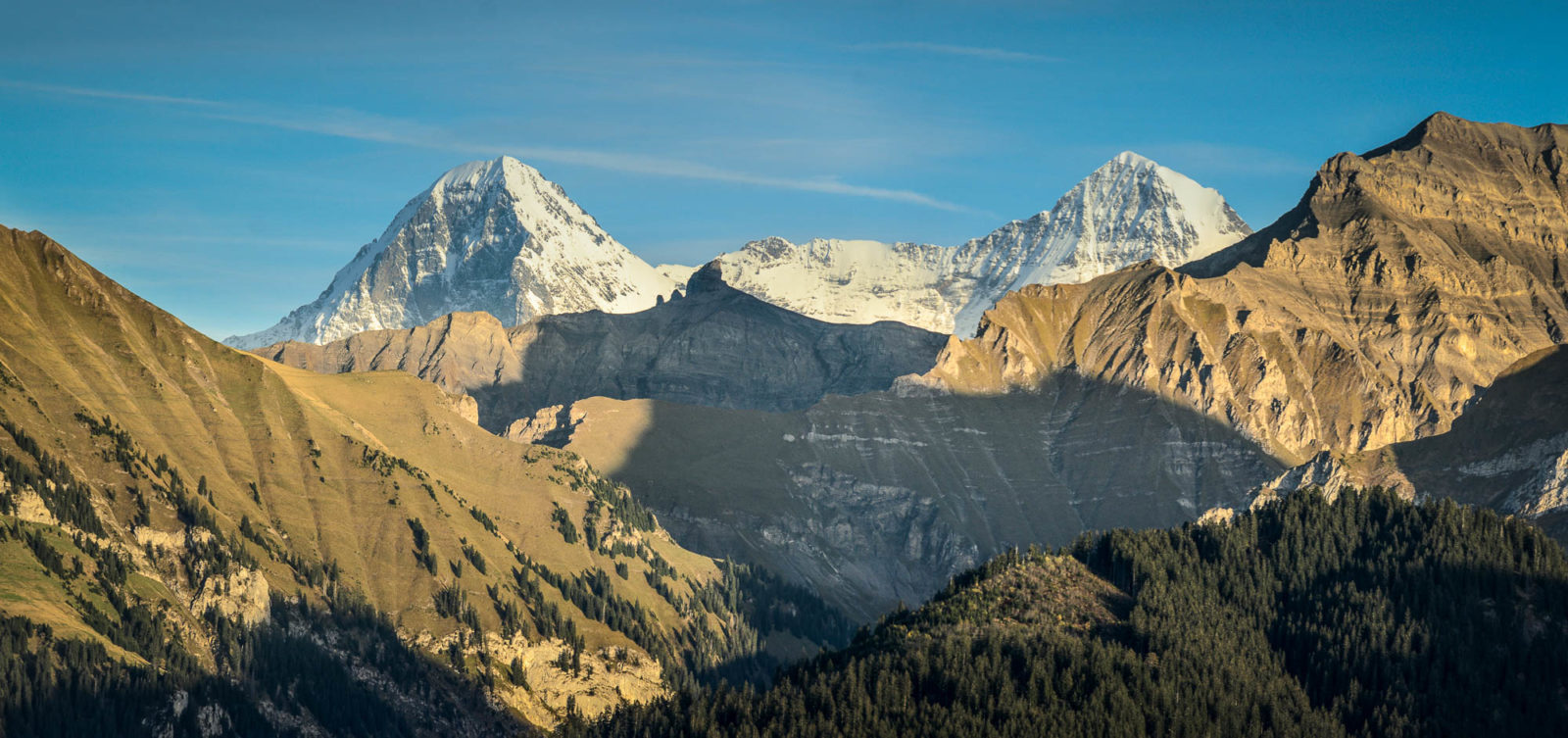
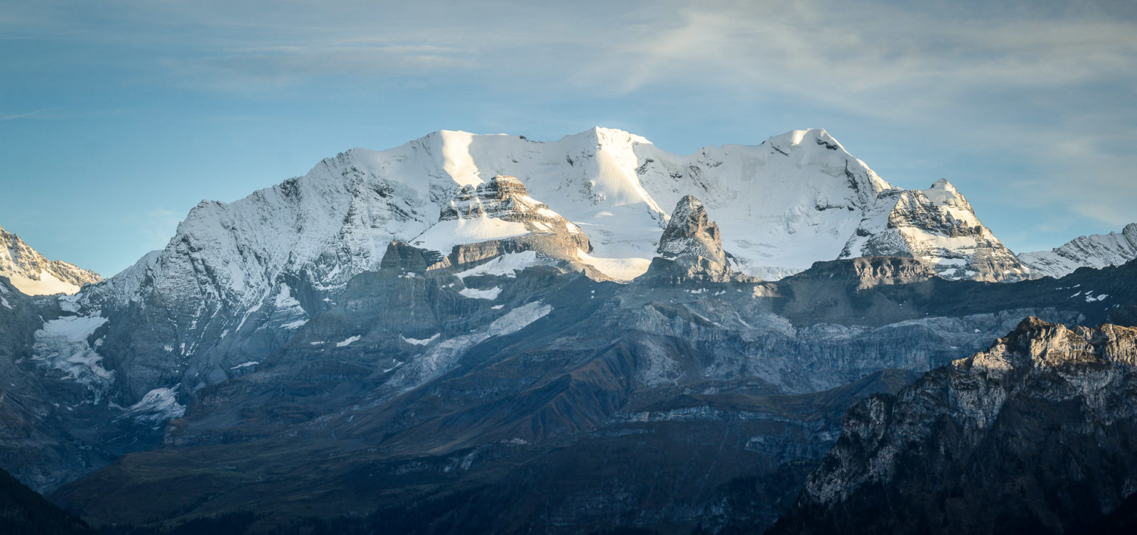
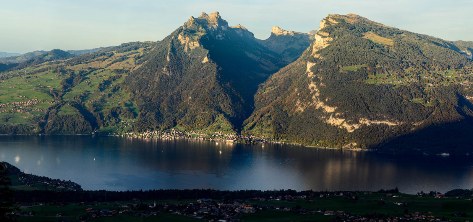
Closer at hand, the surrounding peaks of Blüemlisalp and the tips of Eiger and Mönch, as well as the elevated view of Merligen and its reflections in the lake, were worth the drive alone.