Abandoning a walk to Hohgant (again) for the sake of a more enjoyable afternoon.
The road up to the high valley at Lombachalp is tolled at a comparatively high price, which keeps the hordes at bay, but its splendour draws those in the know and there are plenty of locals here. The path from Lombachalp to the Augstmatthorn is well-trodden: for good reason thanks to its dramatic and far-reaching views. I have walked the paths in summer and in winter conditions, but I want to spend more times achieving other, newer goals these days.
Even during the years I’ve been visiting Lombachalp after my first foray in 2016, the number of cars in the small car park at Lägerstutz has increased and the number of them sporting foreign number plates has also changed. The cattle “gate” — actually just rubber bars across the road which are attached to an electric fence — marks the boundary to the extensive nature reserve, for which vehicular access becomes markedly more expensive. This makes the further reaches of the valley much less busy than they would otherwise be: an ideal destination for the kind of peace and quiet you don’t get in the neighbouring Jungfrau Region.
With the arrival of autumnal yet still-warm weather, I decided to give Hohgant another crack a couple of weeks ago. Having paid for my ticket at the little lay-by in Habkern before committing to the narrow, steep and winding private road up into the mountains, I headed for the remote little parking spot which Jo and I visited back in 2022. Back then, we made good headway up towards the summit, but turned back after our lunch stop, a couple of hours onto the mountain. Achieving the summit was too much for us that day, despite glorious weather.
Although the spirit was willing this time, the weather was a little warmer than I’d hoped for an autumn hike. Sometimes, I just don’t “feel it” when starting out and so the hike is doomed to fail: or at least, a lack of real drive means that each challenge makes me think that I’m not going to make it to my goal. The weather can be an excuse, or the fact that my brain tells me that it’s unlikely I’ll get to my goal, or even worries I’ve brought with me from my daily life which can be a distracting mental load.
After around 2 kilometres and 250 metres of ascent — less than half-way the top of Hohgant — my mental attitude defeated me when each step across even less-taxing terrain seemed to get harder and harder. I cursed myself a bit and got quite grumpy, before realising that this didn’t necessarily need to be a failure. I could plonk myself down and accept my fate for the day, have lunch, and then re-consider my options.

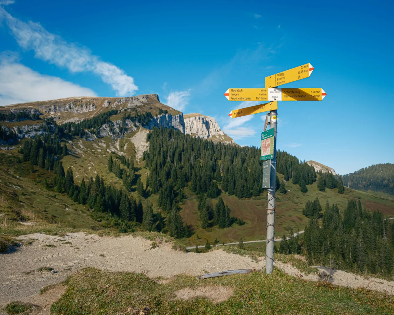
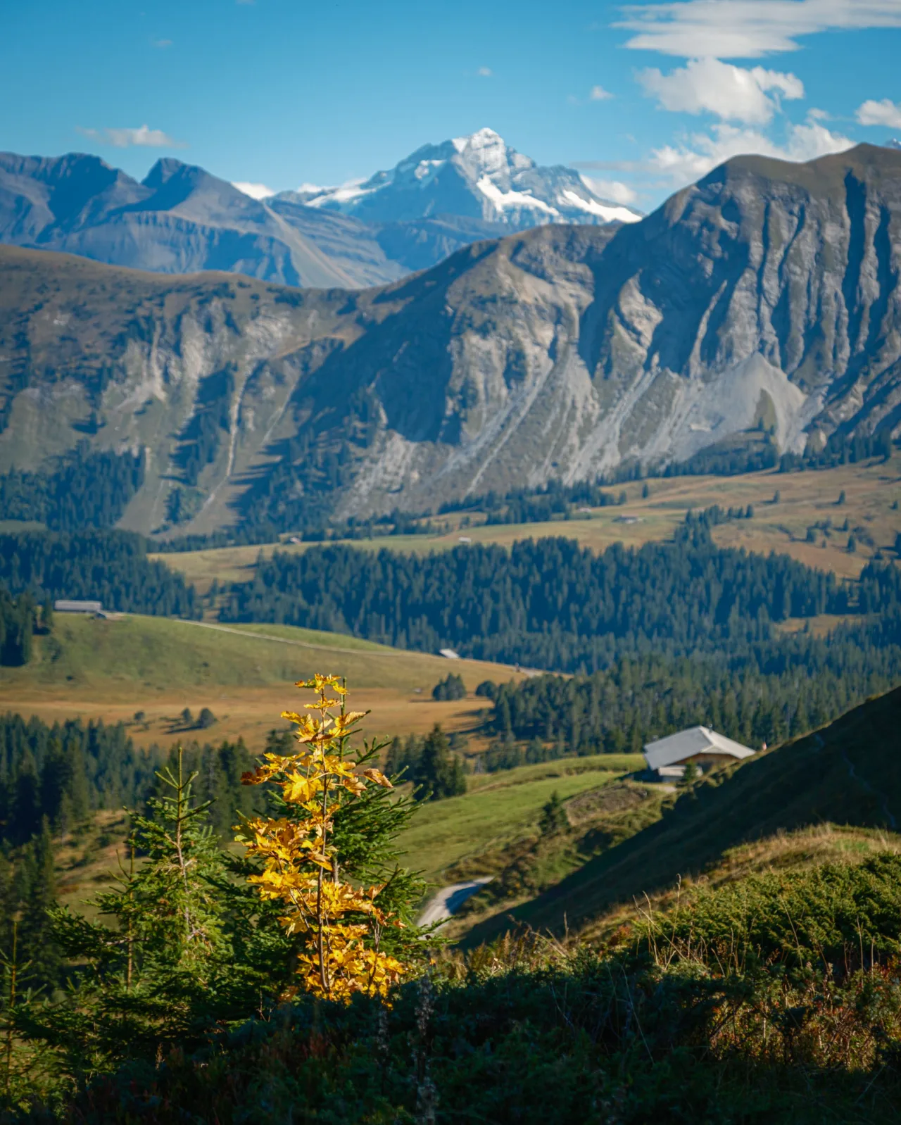
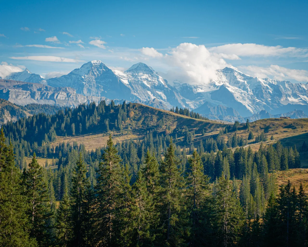
I flopped down into a comfortable spot looking across the forest towards the limestone summit which had evaded me once more, and enjoyed a packed lunch sitting amongst the autumnal undergrowth of a little valley, surrounded by the sounds of insects, undergrowth rustling in the breeze, and two sudden flurries of which I took to be grouse scared from their hunting. I looked back towards the white peaks of the Jungfrau Region and a more gentle ridge walk between the nearby little hills of Stand and Höchst, and decided to make this more of a photographic trip than a summit-gaining one.
Making this decision immediately improved my mood and after getting my camera out of my rucksack, thoughts of failing to achieve my initial goal were immediately replaced with the enjoyment of being creative instead. I took photos of the early autumn colour, returned to the junction of paths at Stand / Wehri, and enjoyed waiting for the patchy sun to illuminate just the right part of the foreground and background.
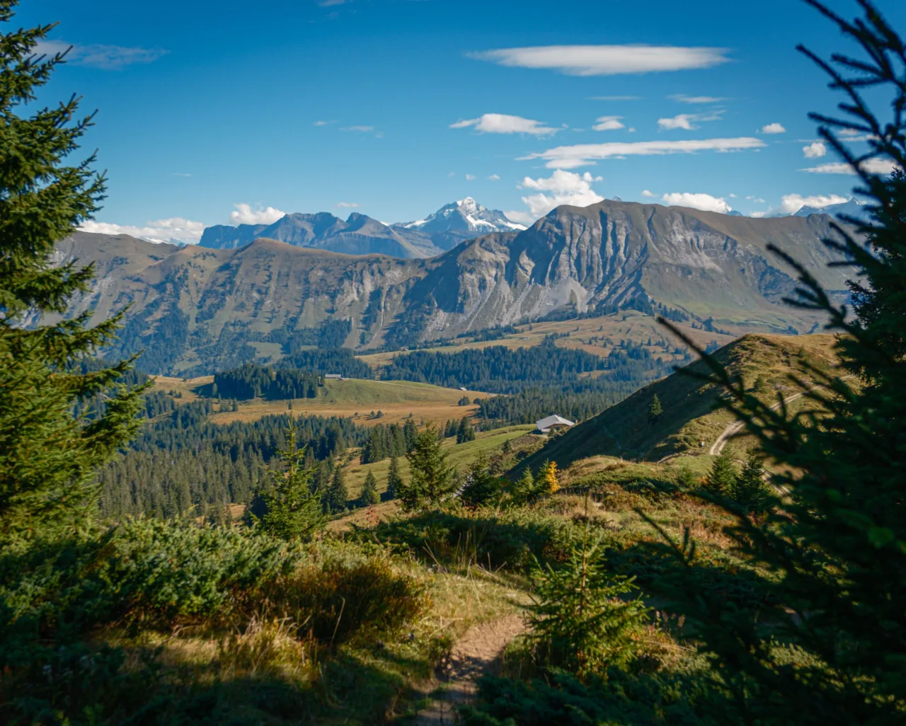
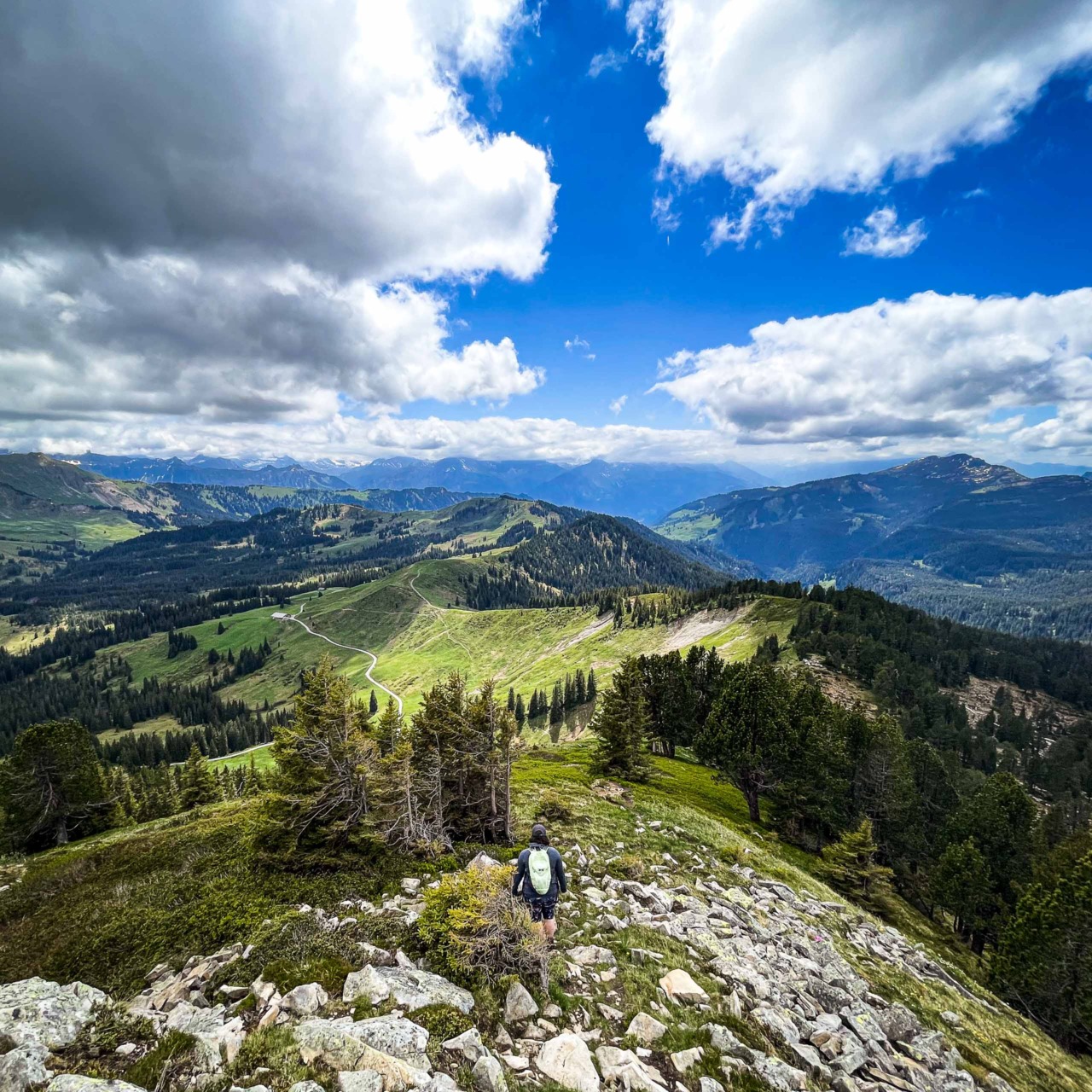
My path from here was obvious: instead of returning directly to the car with slumped shoulders, I walked the track towards the little summit of Höchst, taking photos as I went and sitting by the side of the path for a while to marvel at the huge panorama of the white mountains in the Jungfrau Region. This part of the high valley is exceptionally peaceful and with the silence of the still air, I could hear the vague sound of other hikers a couple of miles away, and was only passed by two couples making their way from the part of the landscape to which I was headed.
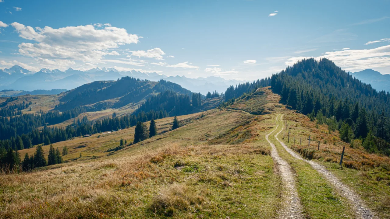
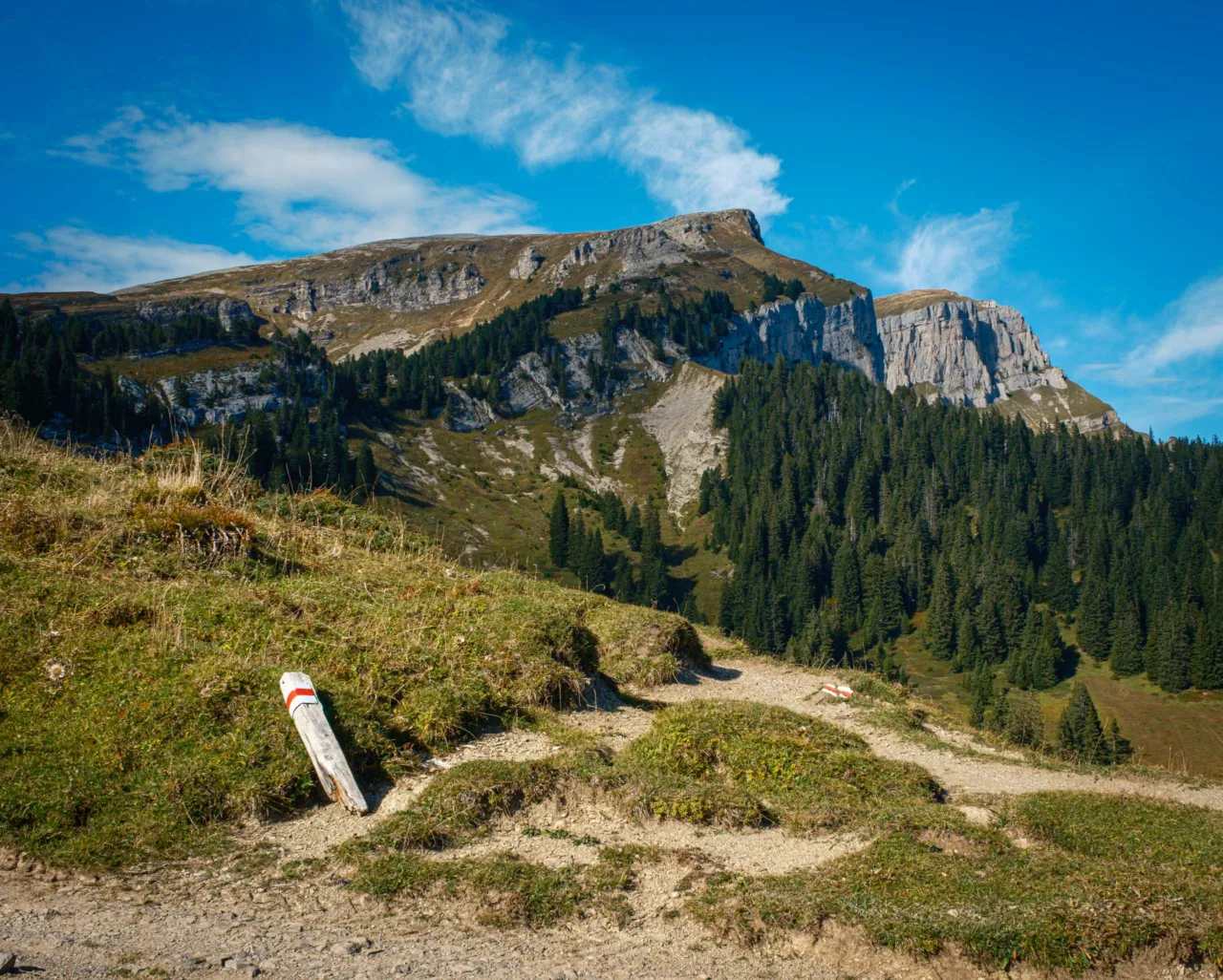
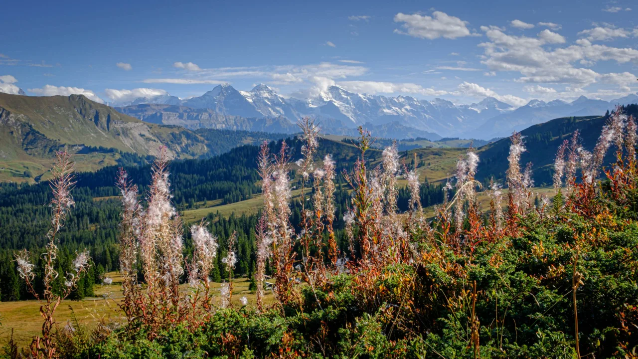
The path leads from the negligible summit of Stand towards Spycher, but I saw some fireweed near the tree-line so I bore off the obvious route and made my way along a barely-there cleared route between low bilberry bushes to get a shot of this attractive and distinct plant, set in front of a backdrop of the higher peaks in the distance.
I’m glad that I took this little detour, as the lesser-trodden path continued quietly into the woods, reminding me somewhat of the path near Peveril Castle in Derbyshire. Although the path was clear once into the woods, a considerable number of spiders’ webs trailed between the bushes shows that it isn’t trodden often, and so the reward of the views back across the valley between the trees were all the better for the knowledge that not many people see them.
From here, the path continues on to Bohlwidegg, Bohlläger and eventually the car park at Lägerstutz, but that route is for another day. I turned downhill and joined the gravel track past Spycher, exchanging nods with two hunters with long guns over their shoulders as I passed, and returned eventually to the road which led me back to my car.
What I learned on this walk was to have a plan in mind, but to be open to changing it if the need arises. The enjoyment of the time spent in the landscape is much more important to me than achieving an over-taxing goal.