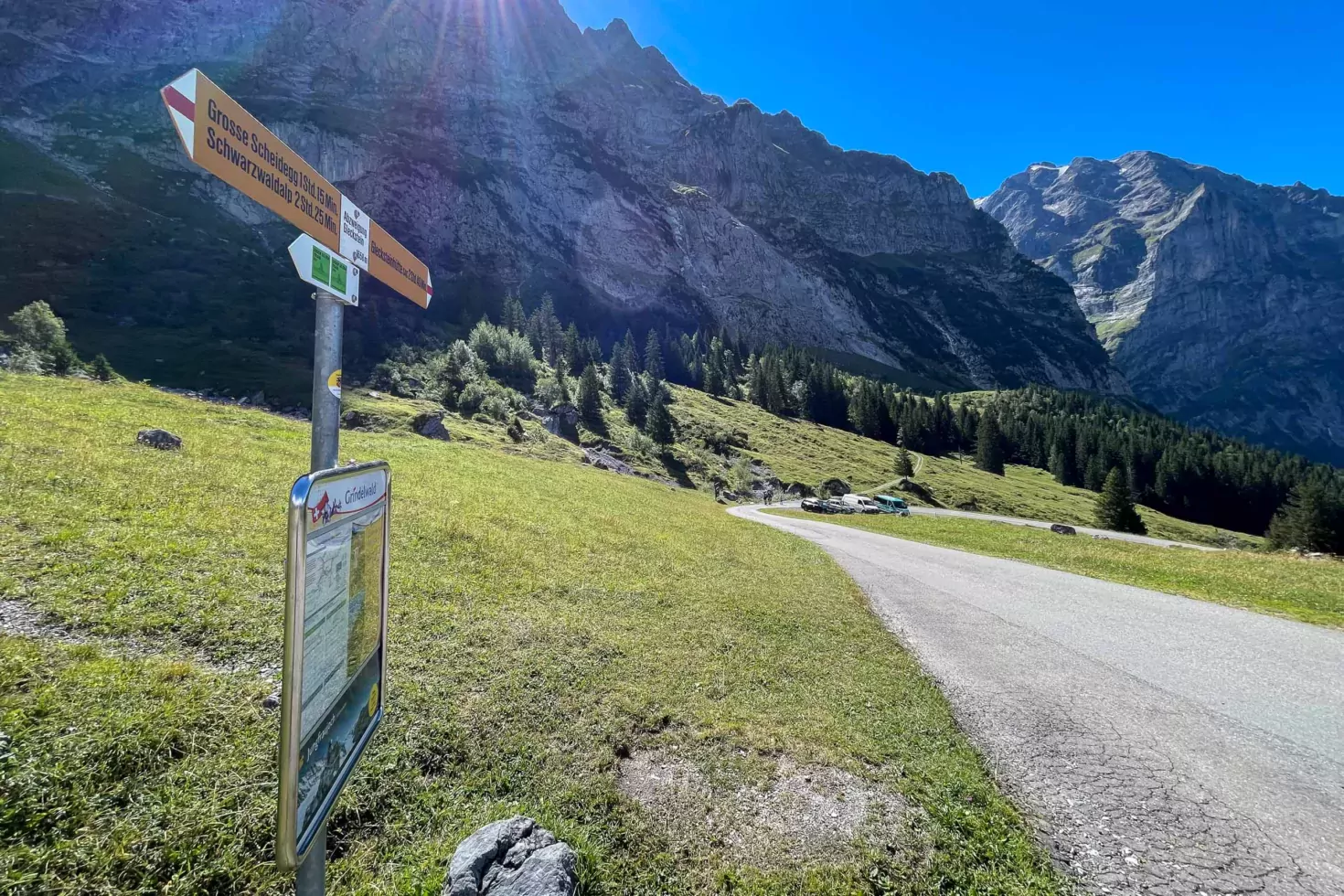
With a name like “Ice Path”, you know before you arrive that a hiking route is going to be a pretty spectacular one. The “Ischpfad” leading up into the mountains from Ischboden (“Boden” in this instance meaning the base, ground or floor of a valley) is one of the more dramatic walks at Grindelwald and takes walkers up into the “proper” mountains, through a large gorge once filled with the Upper Grindelwald Glacier and to the ice fields above. The main stop on the route for the majority of walkers is the Glecksteinhütte mountain cabin; an encouraging sign at the start of the path shows that it takes a fit walker around two hours and forty minutes to get there.
The first time I attempted to reach the cabin was in August 2020. I’d long-since been fascinated by the history of attempts to install a cable-car to the top of the Wetterhorn, abandoned thanks to the outbreak of the First World War, and had often cast my eyes up to the Enge cable-car station. This was first of several intended stations on the first cable-car route in Switzerland, and one which remains (albeit cable-less) to this day.
I parked at the large car park at the top of the public-access road to Grosse Scheidegg and realised that I’d just missed the hourly bus up the private mountain road. Full of beans, I decided to attempt to walk to the old cable-car station, high on the mountain above the car park. Taking plenty of rest stops to get my breath back, I enjoyed the peace and cool breezes before the summer sun cleared the mountains later in the morning.


Around an hour into the walk, the already steep terrain became even steeper, rising sharply as the path took me up grassed-over moraine residue towards the start of the Ischpfad. I’d already gained nearly 400m in altitude over the first hour-and-a-half and by the time I reached the path along which I’d initially intended to start, I was ready for a well-earned break.
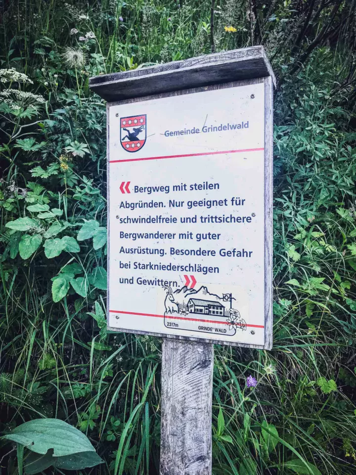
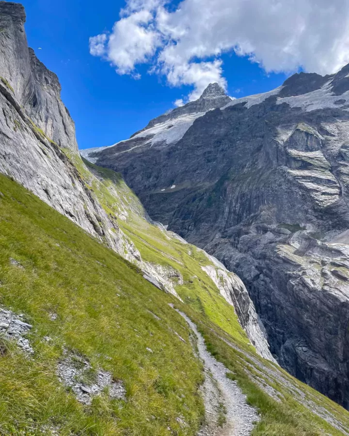
The Ischpfad itself is definitely not for the faint-of-heart: a fact which is spelled-out clearly by a warning sign at the start of the section which leads along the cliff-face. The track along the cliff-face is only steep in a few places, but is vertiginously narrow in others, at which points either iron handles or steel cables are securely affixed to the rock face so that walkers can steady themselves as they pass by. The path definitely requires experience in walking in the mountains and it’s essential that those passing by this way have a good head for heights. On the left of the path is an essentially vertical cliff face; on the right, a sheer drop to the valley floor. This is a path for sunny summer days, not for wet or windy conditions. I don’t envy the first intrepid walkers who found their way along this route to the glacier.
If it weren’t for the fact that I’ve been hiking these mountains for many years, having gained a great deal of respect and caution for the conditions and for the need for experience and appropriate hiking gear, I would certainly not attempt a path like this. Thanks to the popularity of the path with locals and visiting mountaineers these days, some of them heading to the high mountains, there are always people about to keep a reassuring eye out. I even saw a family with young children heading along the route, with the parents roped to their children for added safety.


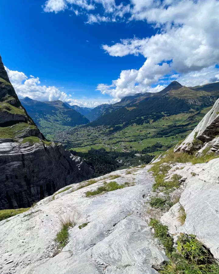
I’ve walked this path during two visits now: once struggling up from the valley car park and once from the higher bus stop at Abzweigung Gleckstein. The path is enjoyable, even if it requires a good level of concentration and physical stamina, and provides marvellous views across the whole Grindelwald valley. The peace is a little spoiled by the regular soundtrack of the three-tone warning horn of the Swiss Post Buses, which take visitors up and down the private road from which I started my walks. That being said, they are some distance away and so not too intrusive.
The first time I walked the path, my goal was the aforementioned disused cable-car station, and I was excited to make it all the way there with some energy to spare. I specifically brought my drone with me on both visits in order to photograph the building, but the light conditions weren’t perfect on my first visit and so I was pleased to have more success on a return visit in August 2022. The added benefit of a newer drone with a much better sensor allowed me to improve on my photos from two years earlier.
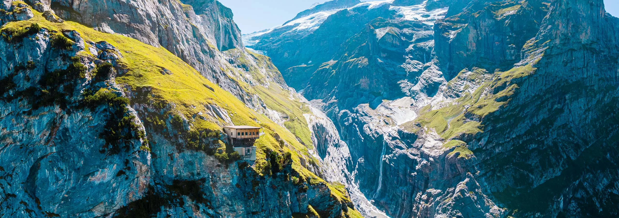
The turning point of the first section of the walk is in the top-left corner of the image above: from here, the path turns east and leads along the northern side of the gigantic gorge formed by the Upper Grindelwald Glacier (now largely absent). On both visits, this point is where walkers are in the sun again and the temperature becomes markedly higher on this section of the path. The gorge is quite simply magnificent and the scale of the cliffs all around, and the distance to the peaks high above, are almost too difficult to comprehend. Although the scenery in the Swiss mountains is pretty spectacular in many places, this gorge is one of the few places I’ve visited which really made me feel like a tiny speck.

On my second visit, I learned from my first visit and planned the walk so that I could be sure of getting the bus up to the start of the Ischpfad. My goal on this second visit was to try and get to the Glecksteinhütte and not just to the gorge. The walk along the gorge was more challenging than I’d expected, not least because of the higher temperatures and the higher altitude which takes more effort to master. I was quite grateful of the dousing provided by a small waterfall which empties onto the path, and made sure to take plenty of photos of this section of the walk.
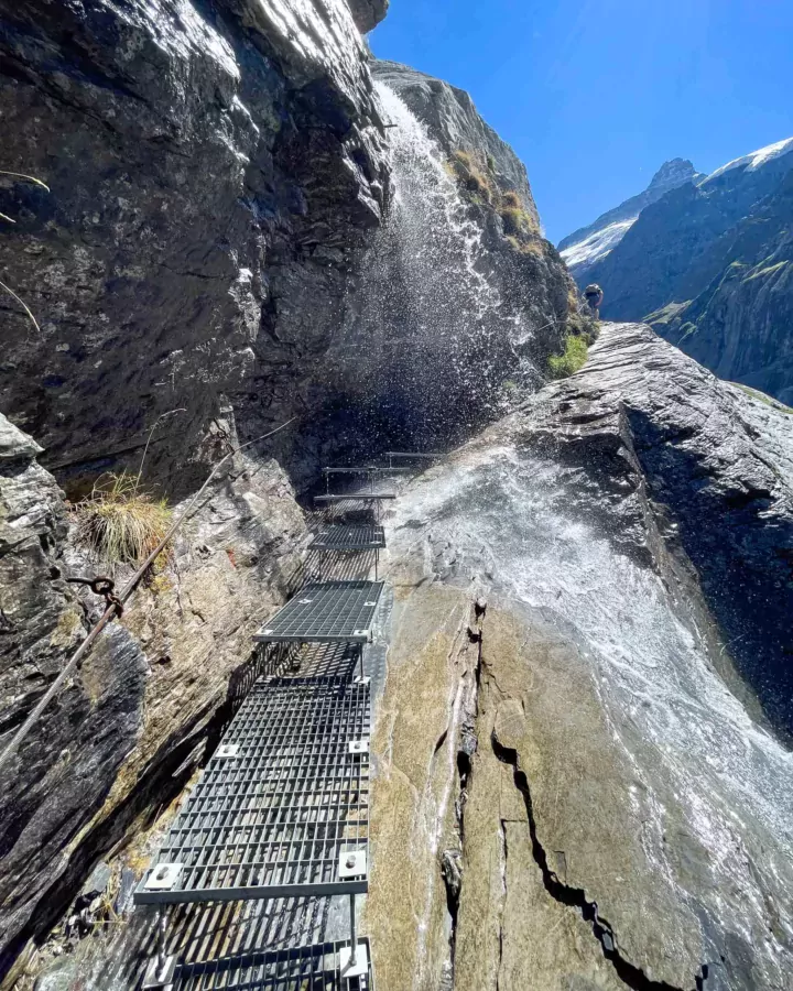
I made it to the section of path below the waterfall at the top left of the large picture above, but realised that I wasn’t going to make it to the Glecksteinhütte because the path was becoming too incessantly steep, and I was beginning to run out of energy. I found a flat rock at the side of the path instead, topped-up my energy for the return walk with the lunch I’d brought with me, and flew my drone around the gorge for a while instead.
