
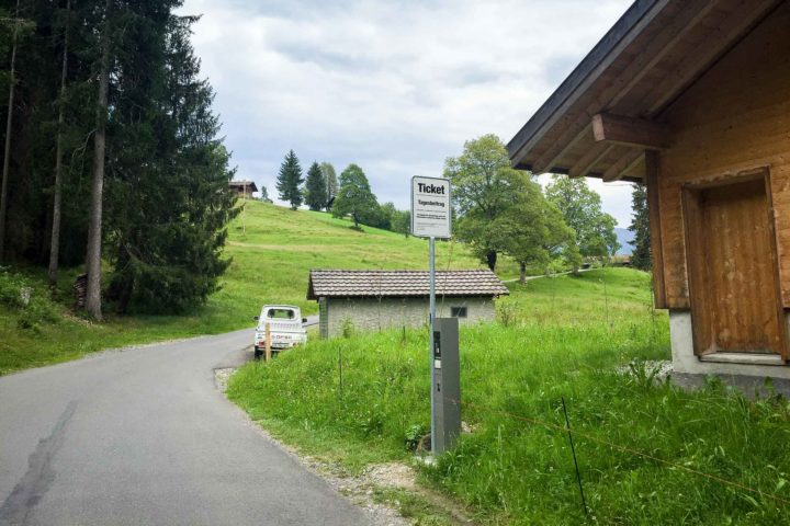
Whilst many travel up to the top of the Niederhorn ridge by cable car – one of the most expensive ones by distance in the whole region – there’s a much better alternative for the fitter visitor. There’s a private, tolled road leading up from Waldegg, at Beatenberg, to farm buildings on the mountain, which drivers can use by purchasing a day access ticket at a very cheap Fr. 5.- from the machine at the bottom of the road. From the end of the road, a range of hiking paths lead walkers to the top of the Niederhorn ridge.
Not many people know about the road, it would seem: today, the only other vehicle I saw was a minibus from one of the paragliding businesses which run from Interlaken, whilst other hikers were choosing to walk or cycle along the road.
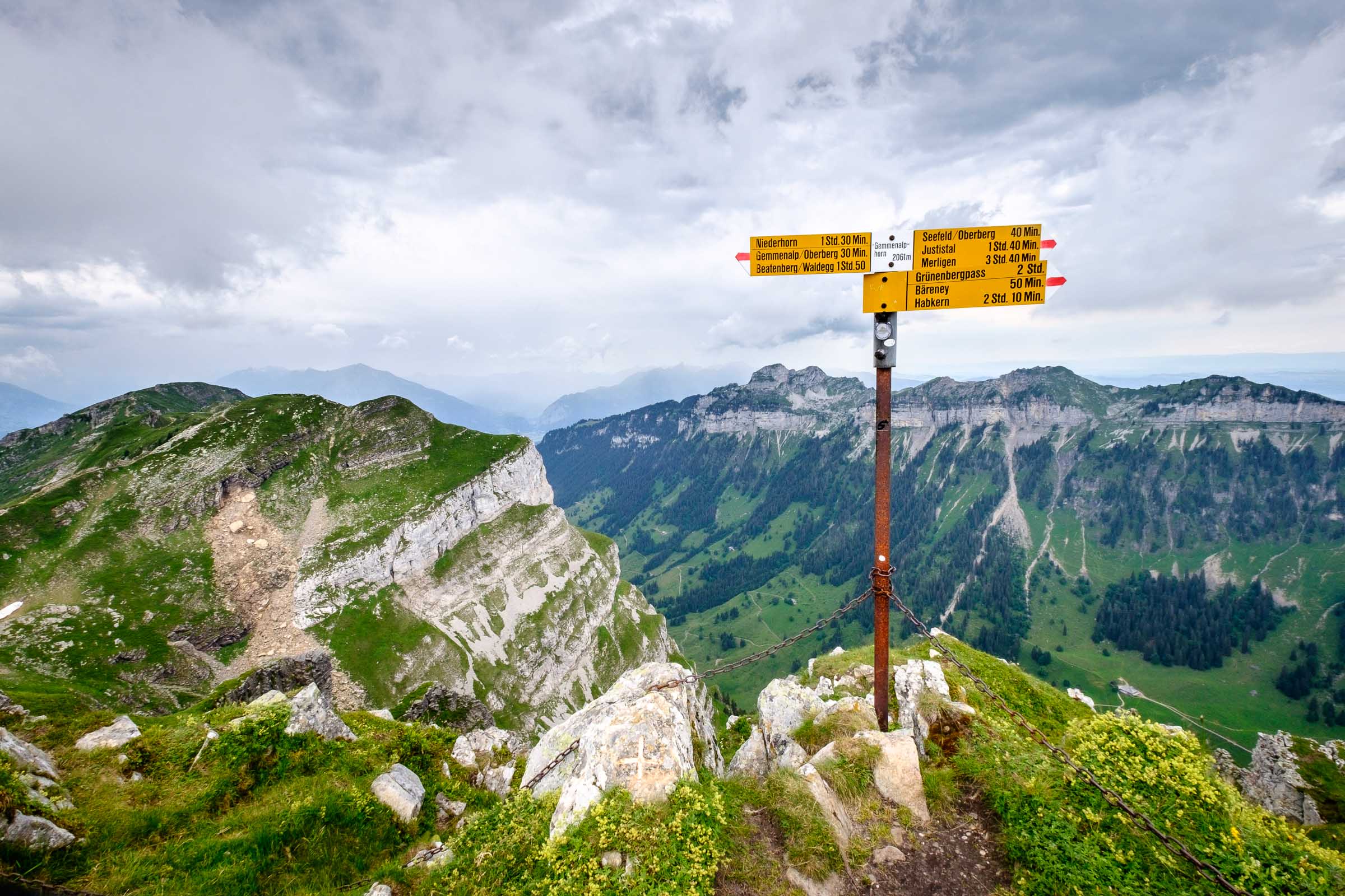
Once at the end of the road, at Chüematte (Cow Meadow, but not the same place as Chüematta / Cow Meadow above Isenfluh), the road turns to gravel and after a few hundred metres, there’s a place to park at the side of the road near some farm buildings. I politely asked the young farmer for permission to leave my car there for a few hours, and then set off to Gemmenalp and the Gemmenalphorn.
My goal for the day was to walk the 1h10 to the Gemmenalphorn, then trace along the ridge to Burgfeldstand and perhaps even on to the Niederhorn. The first twenty minutes of the route is dreadful: a quite steep, straight, tarmaced track which seems to drag on and on, stretching your calf muscles even before you really get going. But once clear of this and onto the alp proper, the landscape and view opens up a bit and you’re into “proper” hiking country. Views range down to Wilderswil, next to Interlaken, and straight up the Lauterbrunnen Valley to the mighty Eiger, Mönch and Jungfrau.

From the meadows of Gemmenalp, the path turns steep again and weaves onwards to the summit across rocky and lightly forested slopes. By the time I was within sight of the summit, I saw that the clouds were starting to obscure the distant Simmental valley, to the south west, which meant rain. I summoned a burst of energy to get to the summit and get a few photos in a chilly wind, before deciding to be safe and return to the valley before the possibly stormy weather hit. Just 35 brisk minutes later, and only mildly damp from the first of the rain, I was back at the car and heading home.
I enjoyed this short hike: it’s steep enough to be good exercise, and rewards with great views of my favourite range of Bernese mountains, some attractively precipitous views to the Justistal valley and across to the Niederhorn ridge closer at hand, and right over the Sigriswilgrat ridge to the Jura mountains in the distance.

Leave a Reply