
The weather in Europe so far this “summer” hasn’t been particularly conducive to going hiking. Lower-level walks have been possible, but continual low temperatures and regular rain mean that the upper routes are still receiving an occasional top-up of snow.
On one of the few sunny, warm days recently, I surveyed the surrounding mountains. Of the peaks with promising hiking routes, only the Augstmatthorn, on the Brienzergrat ridge, was sufficiently free of snow to achieve a summit hike. I’d long meant to visit Lombachalp, behind Habkern, and so I drove up the toll road to a parking area at the start of the hiking trail I’d chosen.
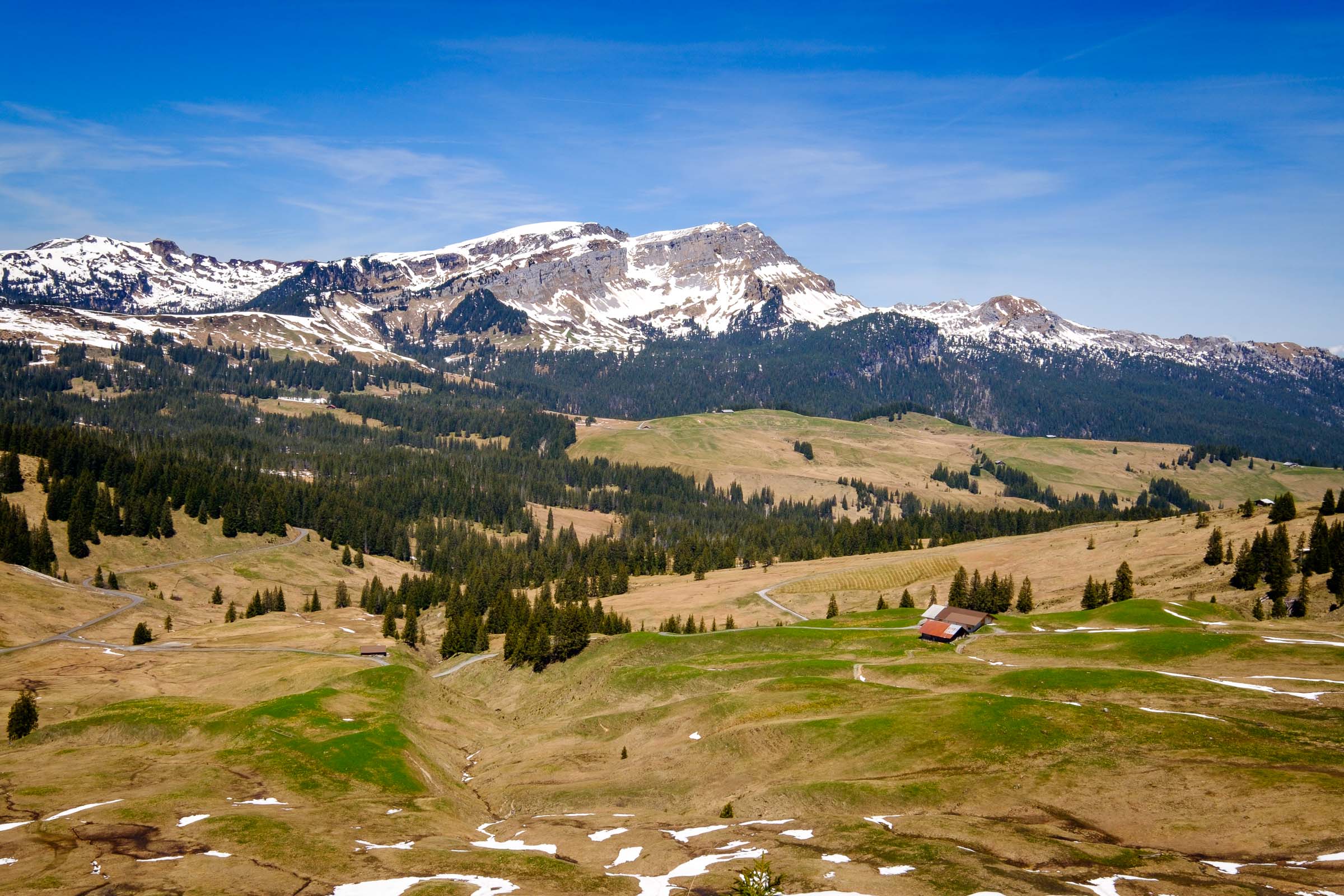
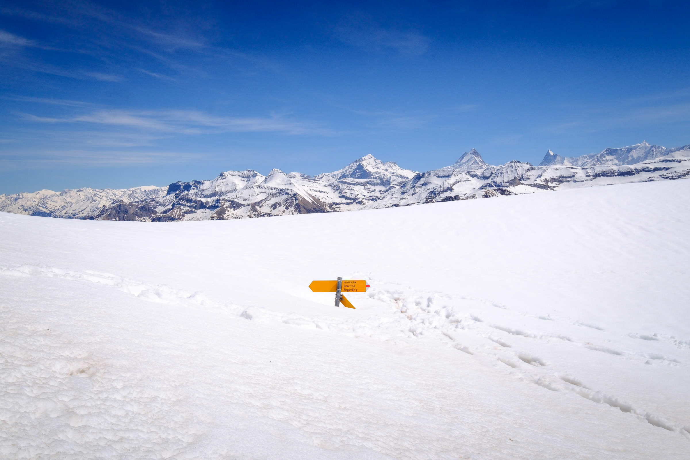
From Lombachalp, I got a good preview of the route ahead. While the peak of the Augstmatthorn appeared high – marked on the sign as a two-and-a-half hour hike away – it seemed achievable. A positive weather forecast meant that I could take my time, and so I set off across the high moor to the bottom of the steep path.
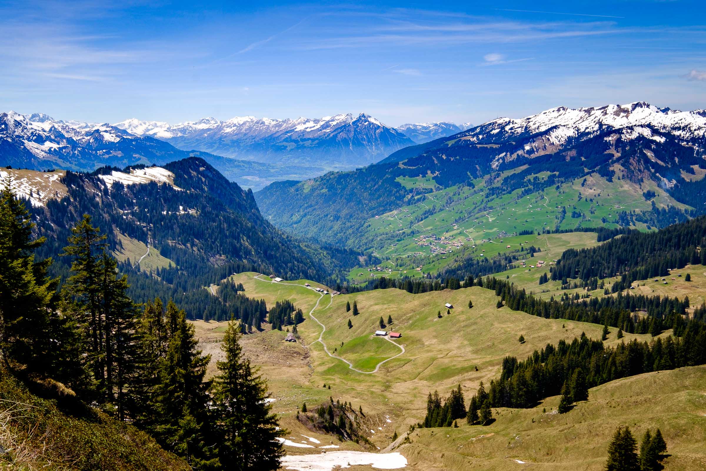
Once across the short moor land section of the walk, the path climbed steeply through small pockets of forest. The high altitude started to make its presence felt and so I took it nice and steady, electing to enjoy the walk rather than push on and try to achieve the summit in the suggested time. The view back towards Habkern and the Niesen chain drew my eye on each short pause. Other hikers walking ahead of my drew slowly away, as they pushed on in a faster tempo. The going was very steep indeed, and made more challenging because of slippery muddy sections, requiring the use of both hiking poles and some hand-holding of root systems to gain purchase a couple of times.
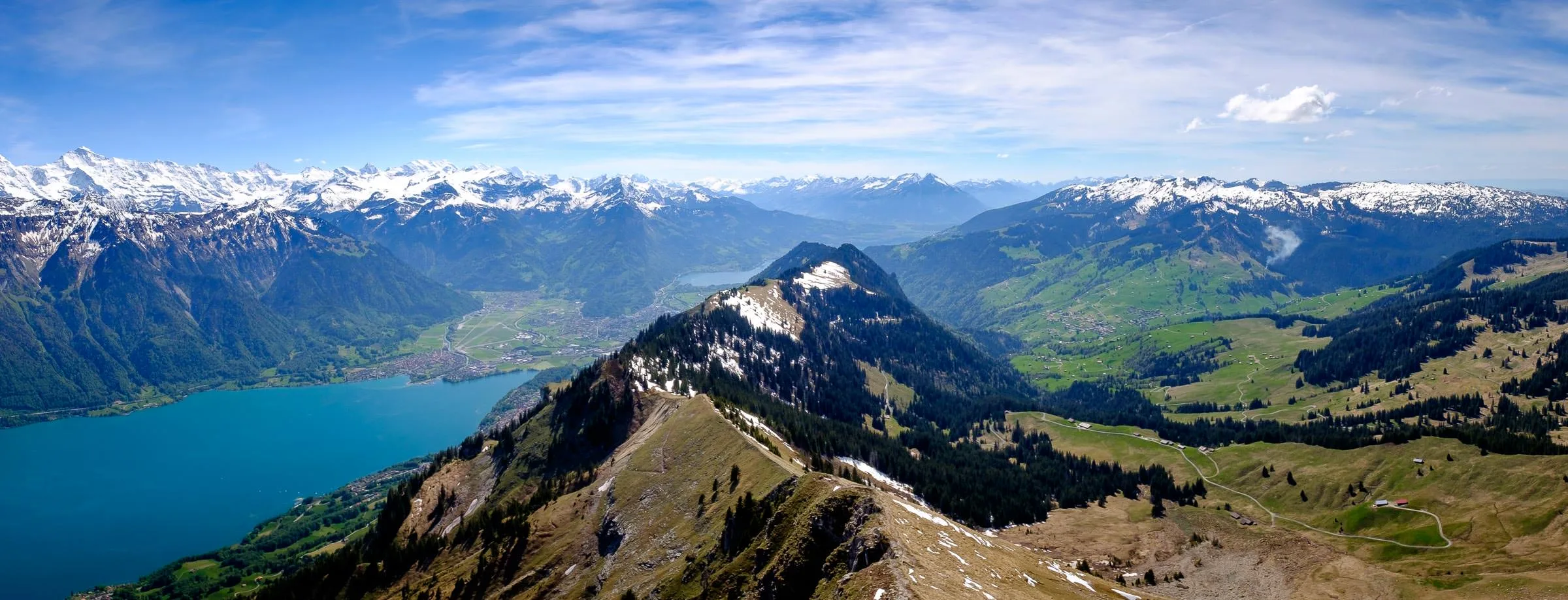
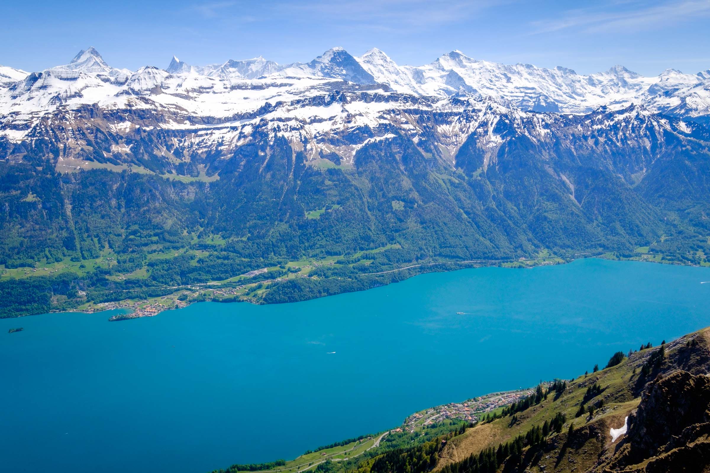
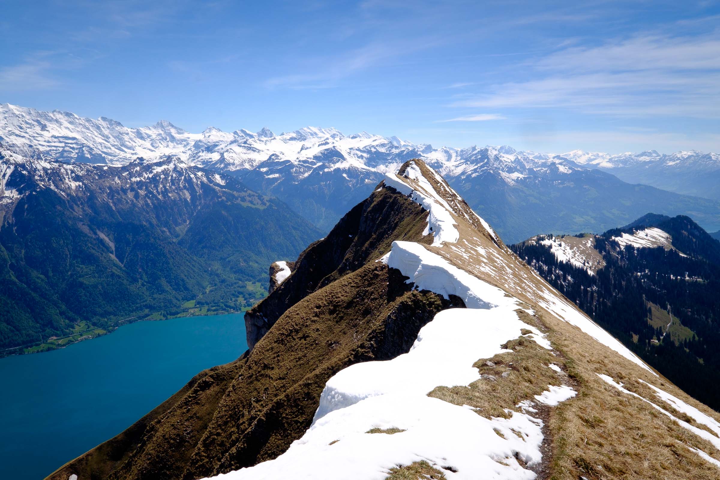
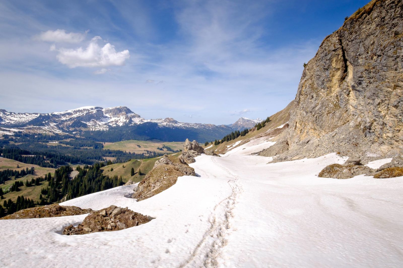
After having to divert away from the last section of path due to snow, I traversed a steep section of meadow diagonally and very slowly before reaching the edge of the Brienzergrat ridge. Cresting the ridge, a little way short of the summit, I got my first sight of the vast, turquoise expanse of Lake Brienz far below, and of the larger mountains of the Jungfrau Region. The little villages of Oberried am Brienzersee and Iseltwald, on the lake shores, were tiny and distant, with model-like boats and a train passing through the landscape far below.
From here, I turned east and headed along the mainly snow-free knife-edge of the ridge; only at the path’s junction just before my goal had the snow collected in a hollow, where I had to clamber up and walk on top of the metre-deep snow mass for a short distance.
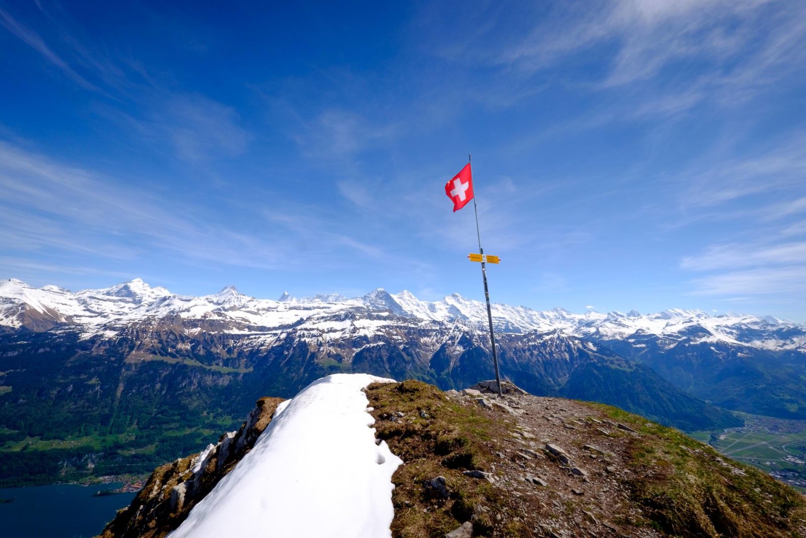
The view from this section of the walk was truly panoramic: a 360° scene encompassing the entire local region, from Brienz and Meiringen in the east to Interlaken and Lake Thun. In the far distance, the comparatively clear weather meant that I could see all the way to the Jura mountains, and the tiny needle of the giant t.v. transmitter on the Chasseral was just about visible on the horizon.
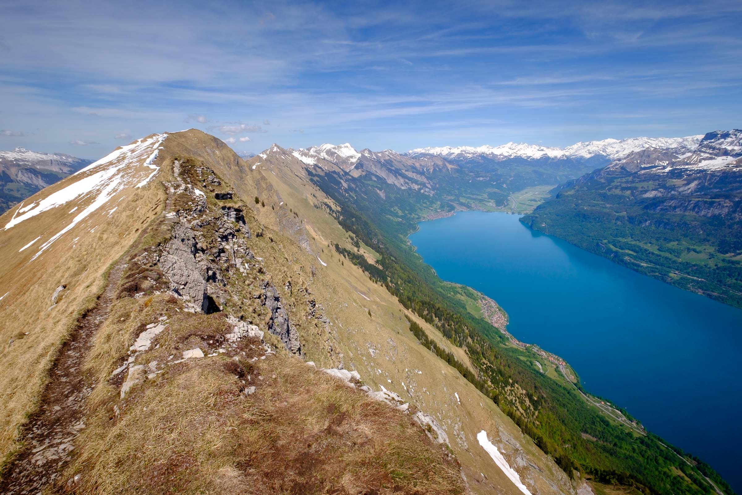
Once I’d had a break for lunch on a bench plank propped between two rocks on the summit of the Augstmatthorn, I returned the way I’d come, along the ridge to the pinnacle called Suggiture, meaning “the peak of the stone pine”. Although the path was clear and plenty wide enough for comfortable walking, this section definitely called for a head for heights, with very steep drop-offs to the lake on one side and to Lombachalp on the other. There’s no consideration for “health and safety” restrictions here. Hikers in regions like this, well away from the tourist goals, are assumed to be aware of their own limits, and to be familiar with the need for care and attention on trickier paths.
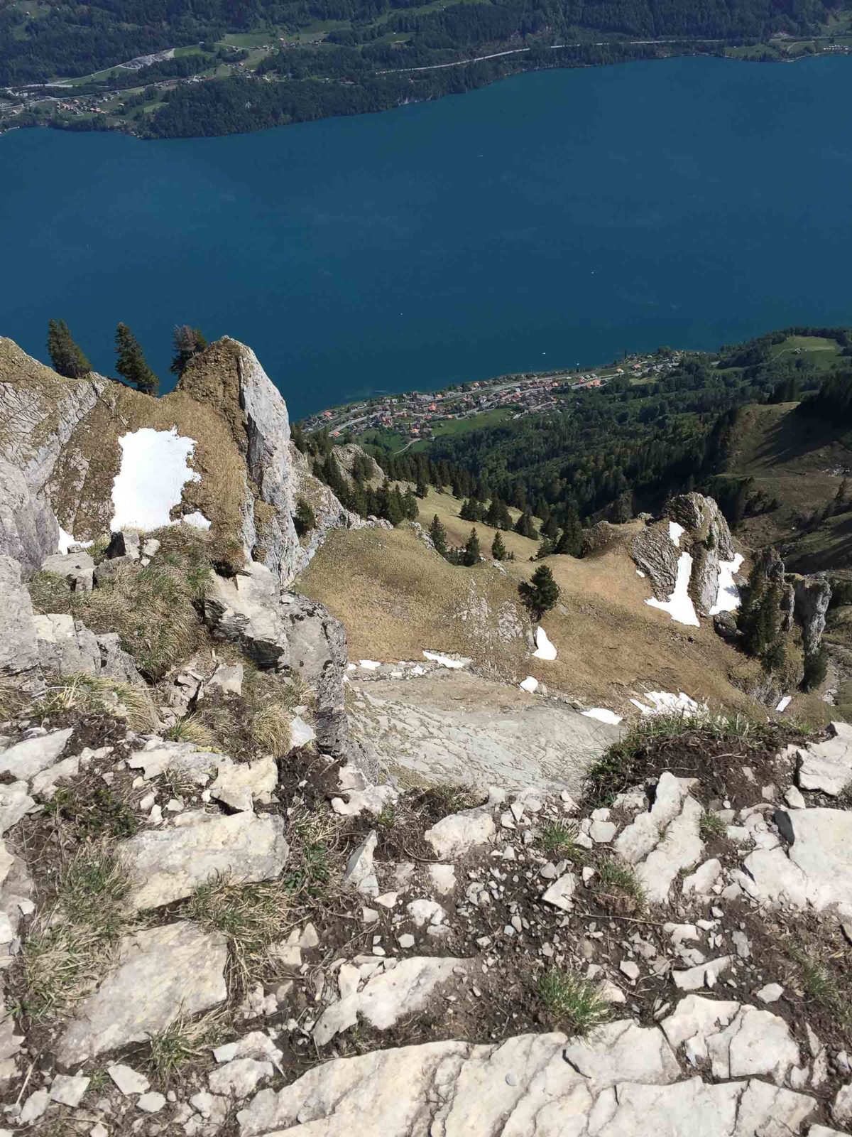
The Suggiture itself proved, in hindsight, to be just outside my comfort zone. The short ascent on the eastern side is very steep and precipitous, and whilst it’s a path ascent and descent to the summit, both sides have been fitted with security cables more common to climbing routes. Standing on the flat summit, I was aware of the first slight signs of vertigo and so after taking plenty of time to slowly get photographs, I made my way safely and carefully back to the hiking path and then started to make my way down on the return to Lombachalp.
The last part of the hike was probably the most physically demanding, as the lower northern slopes I needed to cross were still saturated with snow melt water. After crossing a sizeable section of path still covered in snow, the last section of path back to meet the route to the Lombach Hut was partially degraded after a winter under snow and ice. That slowed me down quite a bit and the 700m of ascent and descent, plus the total distance of nearly 10km, had taken it out of me. After returning to the moorland on the lower alp, I took my last break of the walk by the side of a pleasant little stream, which had found its way through the peat to start heading for the Lombach stream itself, which eventually drains into Lake Thun.

One response to “Lombachalp–Augstmatthorn–Suggiture”