I came to love landscape photography in the 1990s. Once I got the hang of it, I spent more and more time studying images by renowned photographers like Charlie Waite to see how a good landscape photo is composed.
I learned about the golden ratio and about the rule of thirds. I saw how the weather and the direction of light can heavily influence a scene, and I learned that I should take the time to use a map to find a good viewpoint and a compass to work out the direction from which the sun shines at a particular time of day. In latter years, I’ve had an app on my phone to work out sun and moon positions: the current one being The Photographers’ Ephemeris, which is also available for use in a desktop web browser. But these tools are only useful once you know where to find the viewpoint from which you want to take the photograph.
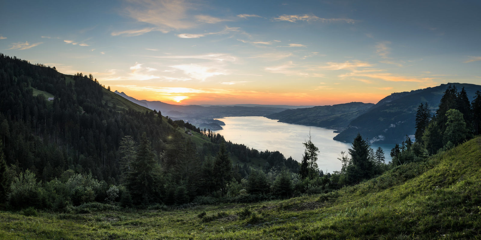
My Dad used to like driving and my parents would sometimes go for random drives up unmarked roads on holiday, just to see where they lead. I have adopted the same habit and I spend time poring over Google Maps or paper maps to see where there might be a good view of a photogenic scene. My first thoughts when seeing some images are “where was the exact point from which that was taken?” or “that would be a good view, if only there was a nearby viewpoint which isn’t blocked by a tree”. Poring over a map is how I found Gasterntal and the great view over Lake Thun from Schlachtenwald. Looking at a map in detail led me to the end of the road above Krattigen, where I found a lovely muted sunset.
I loathe the seemingly endless telephone wires and power lines which are strung across so many views. It sometimes seems as if the people putting them up intentionally position them to stop people from taking photos. (I do know this isn’t true, but it doesn’t always feel like it.) I’m often frustrated to find a truly great scene struck through by big cables hanging between electricity pylons.
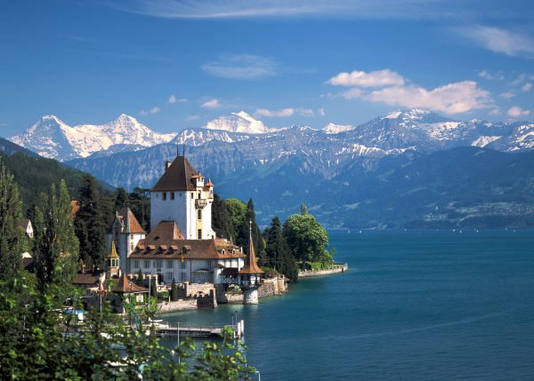
In many places in Switzerland, views in particularly sought-after locations are often blocked by private residences. The worst spot of all for me is at Oberhofen, where there is a truly great photographic view of the lakeside castle, ready and ideally angled for the low sun of a late afternoon in autumn. But after spending two hours walking the steep streets of the village, high and low, I was able to ascertain that the view in the photo below can only be achieved from a garden of one of the private houses. There is not a single other clear view of the castle from this angle, on any street nor any footpath.
I’m never put off from the search, because the reward is often completely worth it. My passion for finding views for classically-composed landscape views remains unabated. I’m lucky that Jo usually has the patience to accompany me on my searches, and I do my best to plan ahead so that I know a trip to a viewpoint won’t be wasted.
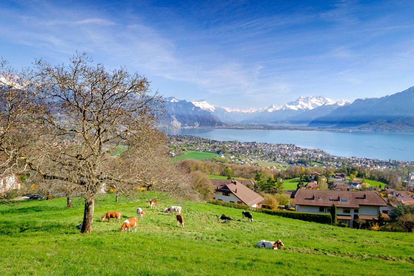
Although it took a little bit of hunting, I found one of my views last weekend: of the eastern end of Lake Geneva at Vevey. The scene works in many ways: the angle of the sun; the curve of the lake shore to draw the viewer’s eye to Montreux and the Pennine Alps in the distance; the complementary colours of the grass and lake; and the cows resting in the foreground. There were other views of the same scene from around the hillside below Mont Pèlerin, but none of them were clear of trees and houses and hated power lines.
The spot in question, on the Chemin des Crosettes in Jongny, ended up being lower down the hill than I’d intended, but the depth of interest from foreground to background led to one of my favourite shots of the day.