
4th October 2014 was the tenth anniversary of our relationship and so we wanted to mark it by doing a memorable hike in the Lake District. After a great deal of to-ing and fro-ing, we decided against the over-awing prospect of Scafell Pike – England’s highest mountain. We both want to achieve this summit, but neither of us had done a comparable hike in the U.K. so we elected to try a slightly lesser peak and see how we would get on.
Helvellyn was the next name on my list, which has been a goal ever since I began enjoying walking in the mountains. But raised eyebrows and rueful shakings of the head when talking to local hiking shop assistants told their story: the weather forecast wasn’t ideal. Tackling the third-biggest peak in England would be tricky. Striding Edge is one of the more notorious hiking routes in England and is known to be a major challenge in less-than-optimal conditions. So we decided over breakfast the next morning to choose again and head for familiar territory – Honister Pass.
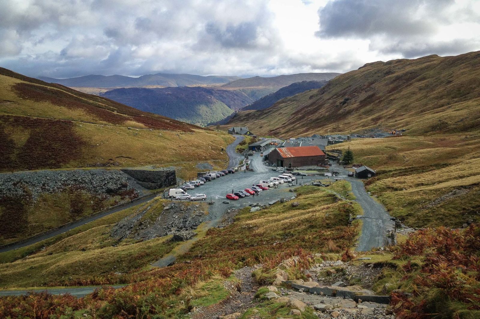
We walked from Honister Slate Mine two years ago, with the goal of “bagging” both Fleetwith Pike and Haystacks, but the arrival of a hail storm and our lack of experience led us to abort the walk after reaching Green Crag. Looking back, we were pretty ambitious – not having done any real hiking beforehand – and we probably deserved the muscle pains that time.
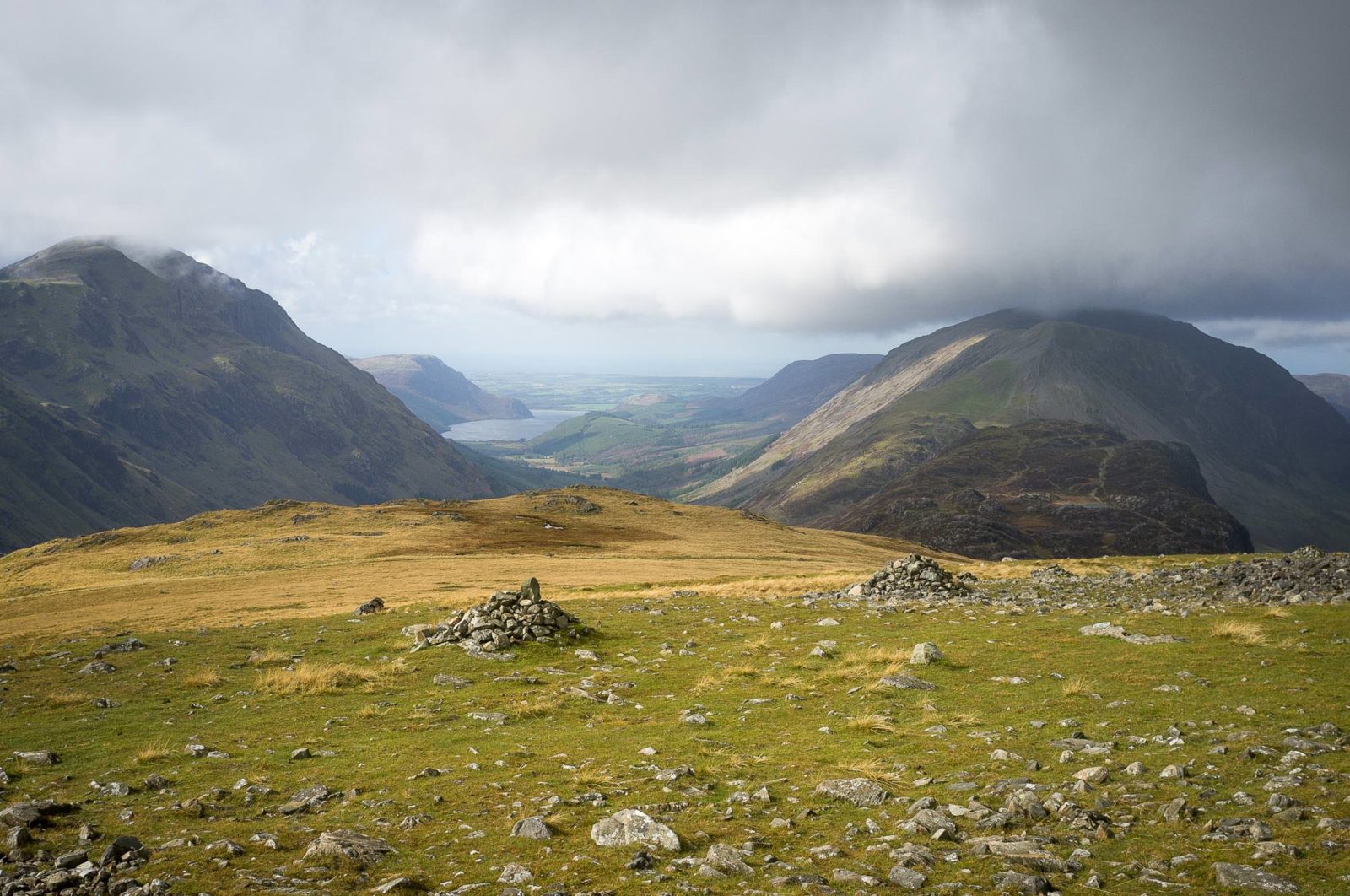
This time, we chose to head up to Fleetwith and decide on our destination once we could see the weather coming in from the Irish Sea and the south-western tip of Scotland. We were exceptionally lucky – after the rain over lunchtime, we would be able to walk in comparatively clear weather. So instead of Haystacks, we elected to commit to a longer and more challenging walk.
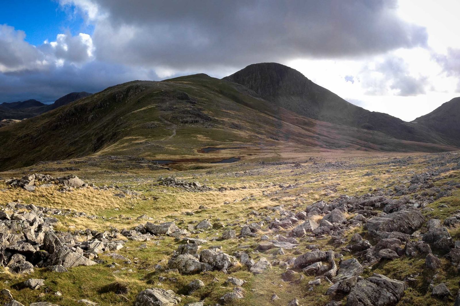
We both gained a proper sense of the challenge ahead when we saw Great Gable for the first time on our approach to the top of the ridge above Brin Crag. Although a fair distance, the walk had been comparatively easy-going to this point. The real challenge lay ahead – first, the steep goal of Green Gable, then a sharp descent down a scree path to Windy Gap and the difficult scramble up the rocky eastern side of Great Gable.
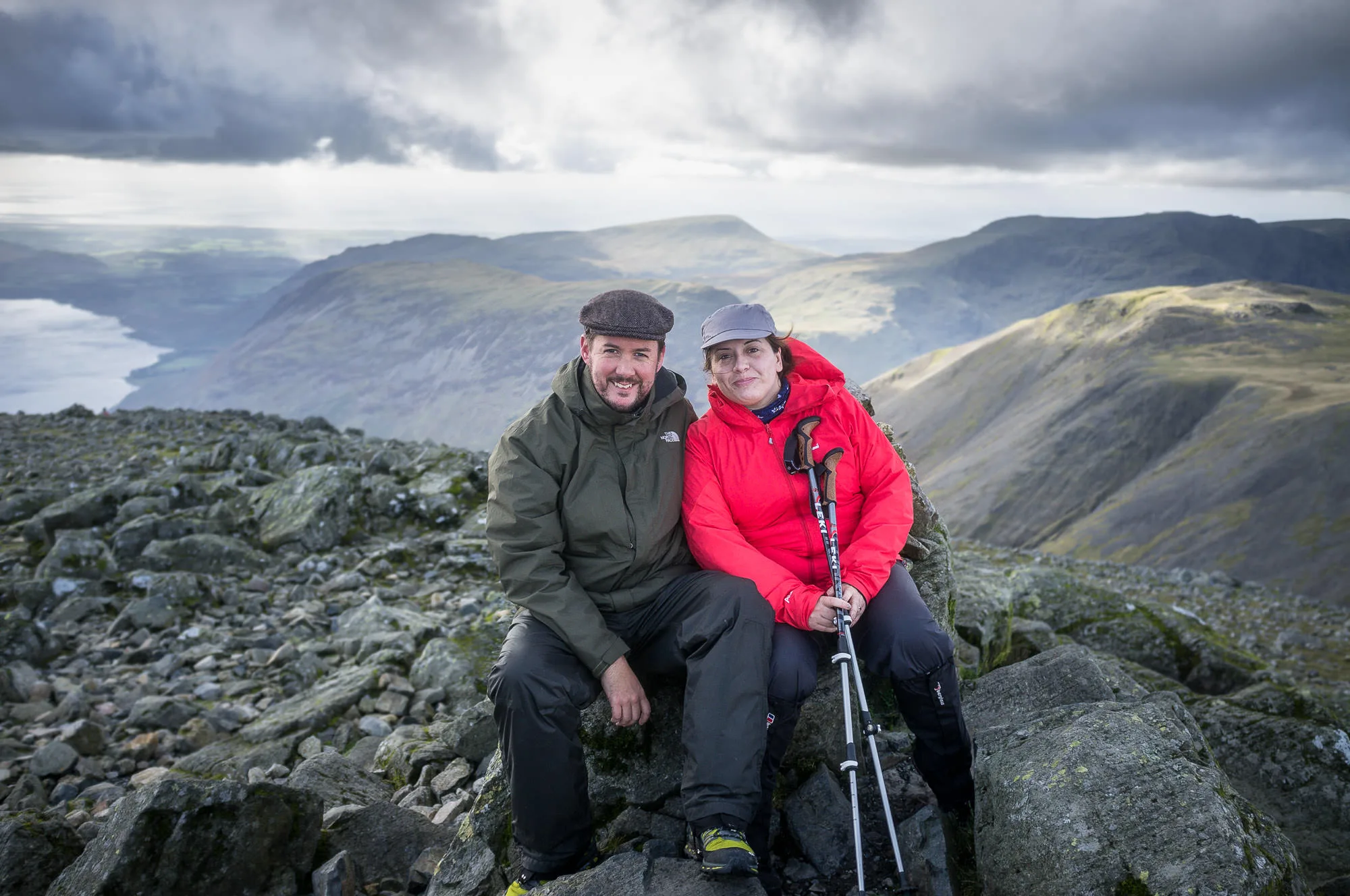
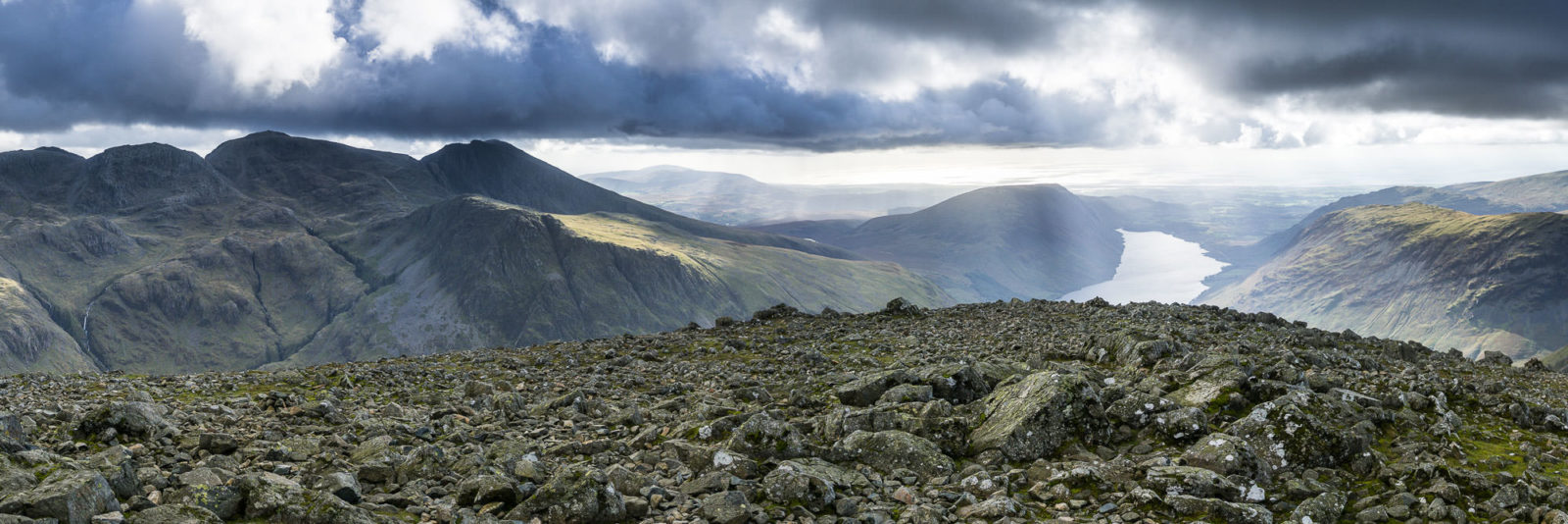
Our legs were getting pretty tired by this stage, but arrival at the small summit cairn and one of the biggest 360° views in Lakeland gave us the boost of adrenaline we needed. Before us, views across the western side of the District and out to the Irish Sea and Isle of Man rolled for miles.
After taking some photos, eating a packed lunch and chatting to the few other hikers on the summit, I took a moment to gaze across to the nearby Scafell peaks – setting myself a mental goal of achieving them next time we’re in the Lake District – before we started off for the long walk back to the car.
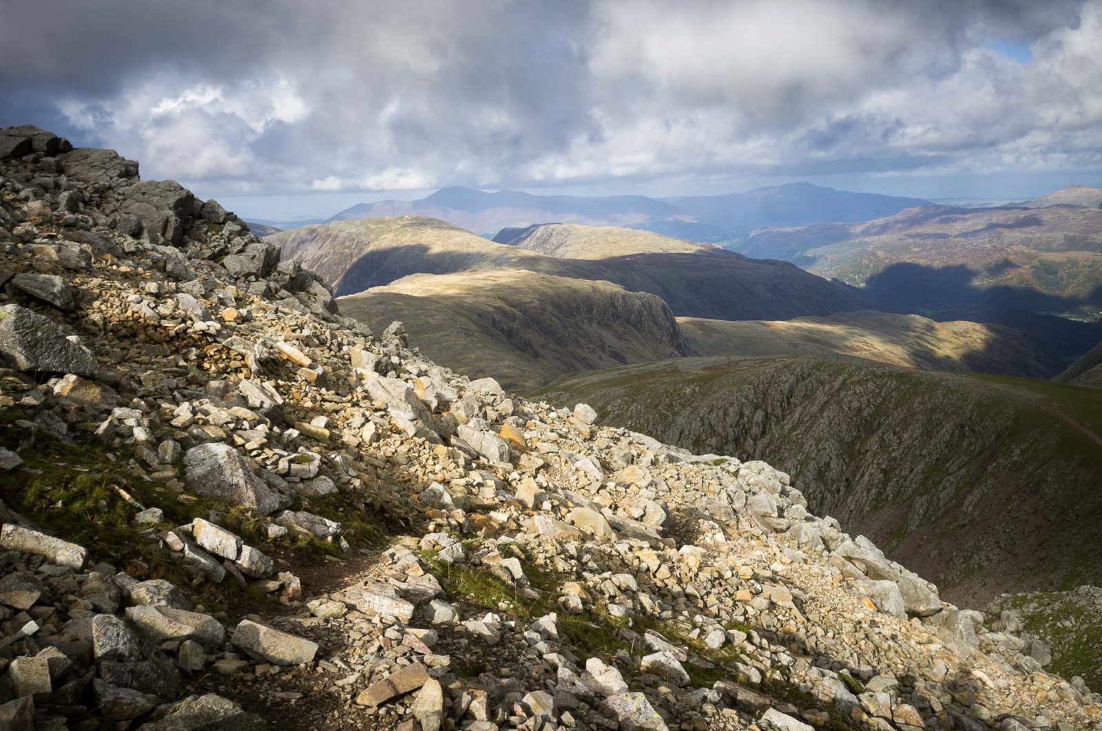
Unlike routes in Switzerland, the paths in the Lake District are usually unmarked and often washed-out by rain. We had a weather-proof Ordnance Survey map with us and used it to determine the main paths, but we were glad of the stone cairns along the route to keep us true.
Most of the cairns aren’t officially placed, but steadily built up through each walker adding a stone to the pile. We did our bit along the way, as the cairns led us to Great Gable – where they were almost hidden in the wider expanse of the rocky slopes – and back to Brandreth and Grey Knotts. These cairns are much more important than the decorative piles of stones one sees here in the Alps – they are a true navigational aid and an integral part of the wonderful British hiking experience.
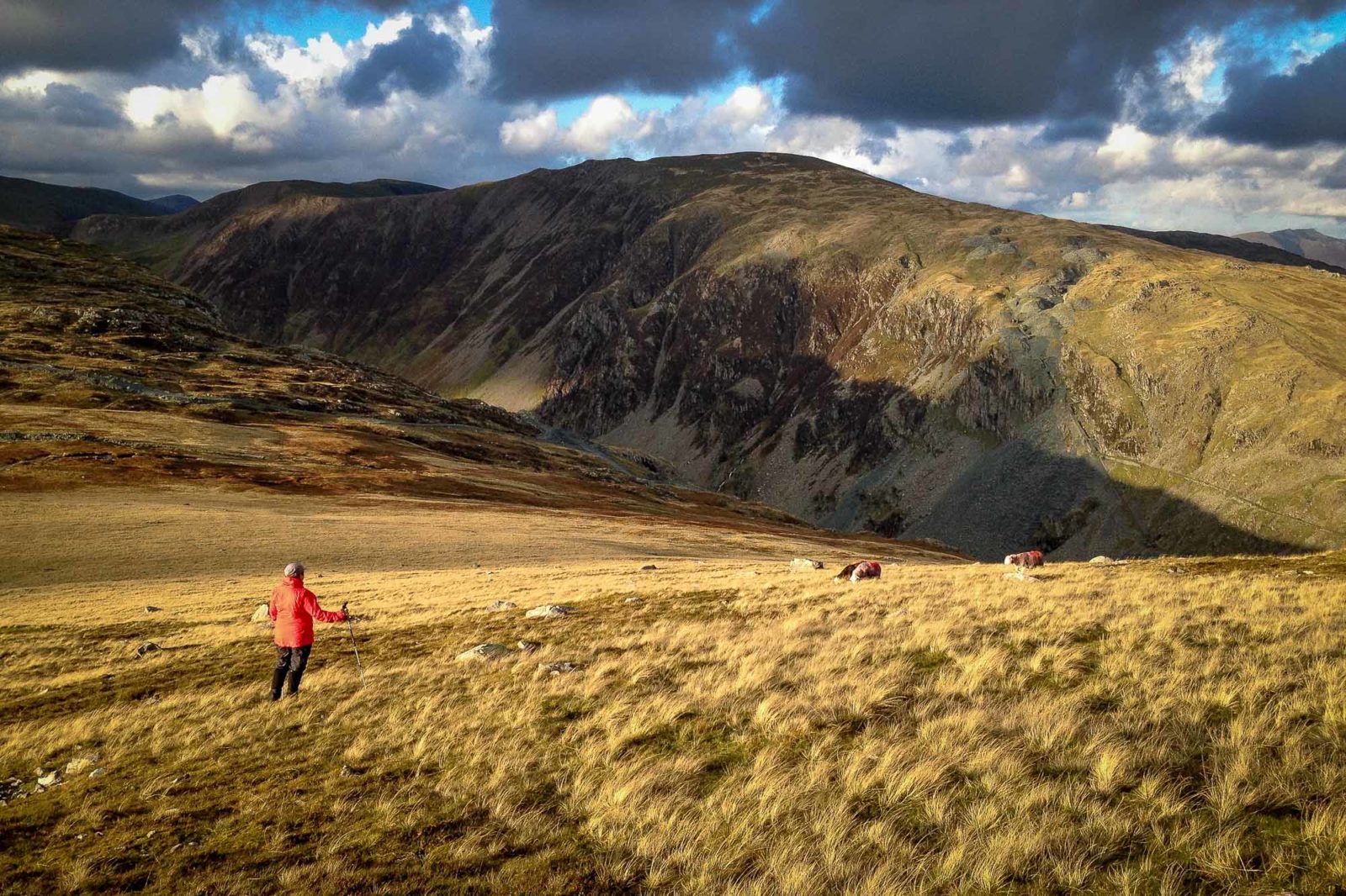
After a couple of brief diversions to outcrops of rock for photographic purposes, we finally arrived at Grey Knotts and picked our way down the steep and grassy slopes towards the top of the disused tramway, which leads between Dobs Quarry and Honister Pass. After stopping off to coo over some Herdwicks (Jo) and to take some photos of the beautiful late afternoon sunlight (me), we made our way down the long, straight track to the end of our ten kilometre walk and drove back to a very welcome dinner.

Leave a Reply